Public Transport
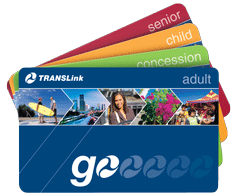
Depending on where you’re travelling you might prefer to drive as public transport may not be the most efficient route in Brisbane. To use public transport in Brisbane you’ll need to get a “Go” transport card.
You will hear the terms “Touch On” and Touch Off” - Touching on means going in/on. Touching off means coming out/off. Make sure you do this whenever you get on or off a bus, train, tram or ferry. It’s sometimes easy to miss the card readers at suburban train stations, but look for them, and make sure you touch on/off to avoid penalty fares. You can lodge fare disputes online with Translink, after you’ve registered your GO card.
The Translink app and Google Maps public transport info can help you, but be aware that they are not always accurate, and buses frequently run early or late, especially at peak times.
Buses
Buses are part of the Translink network, and you pay for bus transport using your GO card. Bus routes are numbered with 3 digit codes. A general rule is that buses numbered with 1xx run to-and-from the south, 2xx means a bus runs to-and-from the east, 3xx means a bus runs to-and-from the north, and 4xx means a bus runs to-and-from the west, 5xx is usually a bus that runs in Logan, and 7xx buses run on the Gold Coast. The main CBD bus stations are at Queen Street below the Myer Centre, King George Square and Cultural Centre. Other CBD bus stops operate, especially at peak hours, and these services are often called “Rockets” (express, limited stops), or more rarely “Bullets” (no stops). If you commute by bus, try to live near a BUZ (Bus Upgrade Zone), or a busway station, and you can get high-frequency and express services within walking distance. Having a high frequency service means that you can more easily deal with delays. It may be useful to figure out alternate routings in case your bus doesn’t show up.
Trains
Brisbane has a number of train lines. Again, they are part of the Translink network, so you can use your Go card. Depending on where you are assigned, and where you live, the train may be more suitable for travel. There are (really) slow all-stops services as well as express services. Most (all?) trains stop at Roma Street, Central, Fortitude Valley, and Bowen Hills. Lines are named after their terminating station or region in the direction of travel, so for example, the Beenleigh line south-bound is called the Ferny Grove line north-bound. The main CBD stations are Roma Street and Central. Linkages between bus and train transport are not great, except at Roma Street, so it may be easier to park at a station, or get dropped off, than to expect an seamless interconnection with a bus.
Walking
The city centre is compact and well laid out. It is useful to walk around and familiarise yourself with the street grid.


